Home -
Resources -
Instructional Activities -
Seasonal Teaching Resources -
Summer Teaching Resources -
Summer Walk Activities
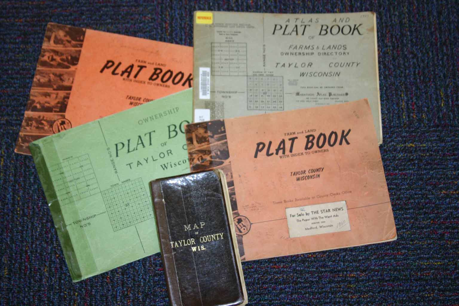
Taylor County Plat Books
Be a Geologist and/or a Geographer in Summer
Geologists study rocks minerals and soils. Some can be seen in the walls of the house, barn, and other buildings near the trail. Why does the land have sedimentary, igneous and metamorphic rocks in such a small area? After rain, some interesting rocks appear on the trail. Think about the way moving ice, glaciers, freezing and melting have changed the landscape. Read about the geology of the area near the school. (See Kalmon, S., 2011)
Geographers look at landforms, water, maps, and the way the earth is described and measured. They think about where they are in the world. They also think about the ways different cultures and individuals have interacted with their environment and how human activities have impacted the world. Be a geographer. Learn about your place in the world by taking a close look at the nearby places where you work or play.
Look at the rocks in the Kuse home. It was built in the summers of 1934 - 1938 with rocks from the nearby land. The builder, Walter Kuse, cut each rock with a chisel and a stone hammer. He wanted to use light colored rather than very dark rocks. What kinds of rocks were used to build the house?
Look at rocks in the dam and the corner of Billings and Allman Avenue. What geographic features made it necessary to build the dam there? How do those rocks keep water from runoff or a heavy rainstorm from flooding the road and tennis courts?
Think about how the use of land has changed. The place where the tennis courts are now was once a gravel pit. The sand and gravel was mined and used to build early roads. The county had a stone crusher that crushed larger rocks into gravel size pieces. They used the crushed rocks on roads that were being built about a century ago.
Look at rocks used to build stone fences. Early farmers had to remove the rocks the glaciers had left behind before they could plow or cultivate the land. They often piled them in rows along their boundary.
Use a road map, plat map, and aerial or satellite photo of the locations where you are walking. Try to place yourself on the maps.
Take a compass on the walk. Use it to find directions.
In Wisconsin, land is measured east and west of the 4th Prime Meridian. In Taylor County that goes along County Trunk E. Look at a Plat Book and read about longitude and latitude before taking a trail walk. Notice that the trail and school are in Section 28 of the Town of Medford. It is listed as T. 31N.- R.1E. That means 31 townships north of the Wisconsin southern border and one east of the Meridian.
Early settlers were very aware of the "Meridian" when they were locating a place for their new farms. They talked about living on or near it. Who lives near it today? Who travels on a school bus or car that goes along the Meridian?
In 1874 when the Lawrence Johnsons homesteaded the land where the school and trail are located, it was described according to its location and the way surveyors had measured it. Look at early survey maps and abstracts. You can also use a plat book to find a land description for the school or the place where you live.
The Kuses bought some of the land from the Johnsons. Some of the land was bought to build the school, or to put in a road for buses. The land was measured again to mark boundaries with neighbors. Look at abstracts and maps that were made. Some of those maps show where corner posts are located as markers. Where on the school grounds would you find the posts that show where the boundary of the school property is located?
Early surveyors had to describe the land they measured. How would you describe the land along or near the trail? (Hilly, rolling, swampy, flat, bodies of water, kinds of trees, etc.) Read early survey descriptions to see if you agree. How may the flora or fauna have changed since the original survey in the 1800's? Why?
Look at pictures or museum displays of the tools early surveyors used. (Compass, chain, transit, ax, notebooks) How were they used? What problems might those surveyors have had? What tools are used today? Why may today's tools be more accurate?
People use GPS devices or sites such as Google to help them find a place where they are or want to go. They need to be sure to enter all the letters, numbers, and spaces in the address correctly. Enter the address of the Kuse Farm Museum (W6219 or W 6219 Allman Avenue) to get a location. In which address would the device take you to the right place? You may be surprised at the results!!!!!!
Some people enjoy geocaching. Talk to someone who does it. If you were to place a cache along the trail, where would you put it and what would you put in it? Why?
Use old photographs and newspapers to learn what resources were on this land when Native Americans, loggers, farmers, school children and others used it. How did they use the resources? Which ones are no longer here? Were the resources used wisely or wasted? How and for what reasons are different groups of people using the land today?
Use your photos. Take pictures of geographical features and cultural changes. Put them on a map of the area.
Sources
Kalmon, S., (2011). Ice Age History of Taylor County, Section I. In Kalmon S. Our Home Taylor County, Wisconsin. Medford, WI: (Privately printed).
Lippelt, I. (2002). Understanding Wisconsin Township, Range, and Section Land Descriptions. Wisconsin Geological and Natural History Survey. Educational Series 44. Retrieved January 31, 2013, from
http://wisconsingeologicalsurvey.org/pdfs/espdf/legdes.pdf
Map of Taylor County Wisconsin (c. 1894). Milwaukee, WI: Fred'k C. Bogk.
__________________________________
Written by Dr. Loretta Kuse and Dr. Hildegard Kuse